Friday, December 30, 2011

Find Piramid In Indonesia !


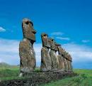
Hunting Pyramid Collection


A group of people investigating the high civilizations of the past. There is a hill to save the pyramid?

The sun was barely above the crown, when four cars pulled up to the edge of Highway Cipatik Soreang-, mid-February 2011. That afternoon, Badaraksa Village located on the hillside, the arrival of guests.

The group was climbing down a small street in the middle of residential areas, heading to the summit of Mount Lalakon, located in the Village Jelegong, District Kotawaringin, Bandung regency.

From Kampung Badaraksa located at an altitude of about 720 m above sea level, they rushed up around the hill from the south to west.

While carrying various equipment and several large cable reels, the group split the mountain forests. Their footsteps as if chasing a cicada rhythm sound, and katydid on either side.

The team, consisting of a group of young men and the researchers that, finally reached the peak as high as 988 meters above sea level.

Cables stretched. The team began installing geoelectric equipment they carry. A total of 56 sensors are fitted with an altimeter (altitude meter) strung from the top of the hill down the slope, each five meters, powered by two electric battery.

The tools that serve to detect the level of resistivity of rock, and can be used to analyze the structure of the density of rock hundreds of feet down. "Our goal was to know whether there are buildings hidden in the mountains," said Agung Bimo Sutedjo, to VIVAnews, in Jakarta, Tuesday, February 15, 2011.

***

Great was the founder Turangga Seta Foundation, an organization that got loose on the mountain of research. Bak fictional character Indiana Jones, the crew did have a passion Seta Turangga traces the history of hunting. Rather than on a desire to have, but history reveals ancestral glories of the past.

The community stood around 2004, fronted by a group of professionals in various fields. There are teachers, building contractors, civil servants, employees of private companies, as well as students. Some of them have more sensitivity to the presence of occult, or their cool term: parallel existence.

"We are all children of MIT. Not Masachussetts Institute of Technology, but Menyan Institute of Technology, "said a member of Turangga Seta Trikoyo Hery, joking. Because, in a witch-hunt of historical sites, sometimes they get support location information of 'informants invisible'.
However, because essentially they are the children who have higher education, their drive to prove that information, was flowing. Not infrequently the 'private archaeologists' are out at night after working hours, to dig a place in order to prove the truth of their hypothesis.

After they found the objects of history they mean, then they fill it again, without being noticed by the general public. "We worry if known many people, even taken or stolen," said Agung.

This time, their arrival to Mount Lalakon in order to prove their theory, that there are a number of pyramids in Indonesia. One of the initial information obtained from their interpretation of the temple reliefs Upgrading.

Seta Turangga Archipelago believes that culture is older than the Sumerian Culture, Egypt, or Maya. They haqul believe Indonesia has a temple or pyramid sites are more and more magnificent than the Egyptian and Mayan civilizations.

"There are hundreds of pyramids in Indonesia, and the height not less than the pyramids of Giza in Egypt is just a 140-meter," said Agung. Although yet to be tested scientifically, Great view similar to the theory of Professor Arysio Santos, who said Indonesia was the lost civilization of Atlantis. (See also: Archipelago harbored Atlantis?)

This belief certainly make many people wince. Turangga Seta had time to post the particulars of their beliefs in the existence of pyramids in Indonesia an online forum. complete with photos. The result, they reap scorn and ridicule. "Later, when everything is proved, they could no longer laugh," said Agung fiery.

***

Great might be boasted. But, it could not. After testing at Mount Lalakon geoelectric, the researchers who came with the Great cs. gobsmacked. They are not just any researcher. They are a top researcher. Some are well-known expert geologist, who no doubt his credibility. But because it comes in the person, their presence there would not be revealed.

At least, their admiration was immortalized in a video recording belongs to the team who witnessed VIVAnews Turangga Seta. "So far I have never found such subsurface structures. It's unnatural (unnatural - ed), "said geologist whose face was often seen in various TV stations.

Typically, a layer of soil or rock layers will be evenly spread laterally or horizontally. But the test results stated there is some sort geoelectric structure that has a shape like a pyramid, and on it there is a layer of rock tuff and breccia with alternating patterns in turn.

Tuff and breccia rock pattern is repeated transversely rather than horizontally, with the same slope. "As if this pyramid dibronjong diuruk and deliberately, so as not to landslides," said Hery, who works as a consultant building contractor.

In subsequent follow-up video footage, geologists had pointed to a blue color formation. In geoelectric test results, the blue color indicates a place that has the lowest resistivity. "It may be a kind of cavity that can contain water or clay," geologists explained. Formation was a kind of door.

What is clear, geologists continued, most likely the findings are man-made structure, because the natural process does not seem likely to produce a pattern of such rocks. "This is clearly man-made," he said.

VIVAnews had confirmed one of the geologists who participated in the research team to Mount Lalakon Turangga Seta. At first he refused, and said he did not know anything existence of pyramid-like structure beneath Mount Lalakon. But lately he implicitly admits that.

"I have no comment," said the veteran geologist Andang Bachtiar to VIVAnews, Wednesday, February 23, 2011. Furthermore, former Chairman of the Indonesian Geologists Association (IAGI) it says the results of the analysis was still not able to conclude anything. There are still many things that need to be proven, said Andang.

But Andang later admitted, in addition to Mount Lalakon in Bandung, he also accompanied the team tested the Seta Turangga similar hill in the area Sukahurip, Pengatikan, Garut regency, West Java.

According to Agung, his team has done testing of geoelectric and seismic tests on 18 points at several places in Indonesia. In Bandung and in Garut, they get roughly the same results. All similar: an indication of a pyramid-like structure at the bottom of the hill.

The difference, in the hill-pyramid on the Main Page not found a cavity such as doors, as well as in Bandung. "Maybe because we only tested in one part of the hillside," said Hery Trikoyo. Unfortunately, Turangga Seta still shut their test results elsewhere.

***

Seta Turangga claims there are still hundreds of other pyramids spread throughout Indonesia. One other Seta Turangga frontman, Timmy Hartadi, in their Facebook page says that the pyramids were scattered in Sumatra, Java, Bali, Borneo, Sulawesi and Papua. (See Infografik)

Claim the discovery of a pyramid hidden in the hills, not only happening in Indonesia. This claim is also briefly appeared in Bosnia. In 2006, an author named Semir Osmanagic claimed invention, and had said they found hidden in the hill Visocica pyramid, the city of Visoko, which is located northwest of Sarajevo.

Osmanagic says the excavation of the pyramid that involves archaeologists from Australia, Austria, Ireland, Scotland and Slovenia. However, some archaeologists called Osmanagic reject the claim.

As quoted from the site Archaeology.org, archaeologists from Canada called Osmanagic, Chris Mundigler claimed never to support or agree to work on the project. "This scheme is a vicious lie against the common people, and will never have a place in the world of science," said an official statement from the European Association of Archaeologists.

What about the claims of the pyramid in Bandung and in Index.php?

In geomorfologis, the shape of Mount Lalakon in Bandung and Mount Sadahurip in Garut does have a shape similar to a pyramid. They have four sides are almost symmetrical.

Mount Sadahurip Main Page (Credit: Turangga Seta)

"The shape is symmetrical it really so? Pointy is very symmetrical, "said senior archaeologist Professor Edi Sedyawati, when encountered VIVAnews at his residence in Jakarta, Wednesday, February 23, 2011.

However, said Edi, claims and test results of geoelectric still not enough to get a final conclusion. The next step is extracting the sampling experiments by loading a test bed to find out what is true there are indications of cultural layers and no traces of human activity or not.

"But this should really be asking permission archaeological excavation of ancient asylum office and involves archaeologists, because there must be accountability and reporting, from the milli milli (millimeter, red)," said Edi Sedyawati.

Seta Turangga also seek permission middle soil sampling at Mount Lalakon to the Government of West Java. "We just need to dig up the soil at the site, about 3-4 meters wide with a depth of about 3 meters," said Agung.

***

Tread Stone, Paseban Mountain, near Mount Lalakon BandungGunung Lalakon hill surrounded by several others such as hills Paseban, Pancir, Paninjoan, Pasir Malang. On the hill Paseban there are three pieces of stone, two of whom are adult human foot, and soles of the feet of children.

According to Edi, if it's true heritage rock sole, this possibility comes from the megalithic era. Palm stone has also been found in other places, such as Ciaruteun inscriptions, relics of the kingdom of King Purnawarman Tarumanegara. "Cap soles of the feet are usually enshrined as a monument to commemorate the leader of a region," said Edi.

Stamp of the foot is also closely related to the concept Triwikrama or three steps that evolve in time. At that time, they believe if someone will ascend into the world of the gods, they should be kicked so hard to be able to jump very high.

Meanwhile, on Mount Lalakon there are also several rock sites, such as Batu Lawang, Pabiasan Stone, Stone Shop, Stone Fertilizer, Renges Stone, Stone elephant, and a long stone that lies on top of the peak.

Refer Abah, community leaders Badaraksa mountain village LalakonMenurut Refer Abah, community leaders Badaraksa Village, philosophically, Mount Lalakon are symbolic of a play of human life. The stones were representing various professions play or selected by humans.

However, the presence of the stones were often misused. Many people come to place a stone on Mount Lalakon looking pesugihan. In fact, according to Jujun, Islamic religious leaders in that place, had many people come to Batu Gajah sought inspiration gambling tail. "Many of them managed to win," said Jujun.

Jujun explains, in Mount Lalakon also routinely held rituals starting reinforcements, namely by making the rice cone and then distributed and eaten by the population. "This event is held every year, usually every 1st Syuro."

Unlike the tradition in Mount Lalakon, communities around Mount Sadahurip relatively more 'modern'. According to Nana, of Kampung Pasir Cicapar, Mount Sadahurip nearest village, there was no tradition of starting reinforcements. The community is also not too concerned with the myth of the mountain in the past.

***

Expert on the history of the University of Padjadjaran, Prof. Dr. Herlina Nina Lubis, said in Tatar Sunda covering West Java, Banten, Jakarta, and part of Central Java province, especially the highlands such as South Banten, Cianjur, Sukabumi, Bandung, Garut, Brass, and Bogor, many found the relics of megalithic culture. -The remains were the remains of which were stone menhirs, building terraces, a stone mortar, stone coffin tomb, stone dakon, and megalithic statues.

However, Nina explains, the history of the Tatar Sunda not recognize the building of the pyramid because there was no custom in Tatar Sunda makes building a pyramid with a height of nearly hundreds of meters as shrines. "The shrine at Tatar Sunda is often called a multi-component sites or sustainable sites," said Nina via electronic mail to VIVAnews.

When the prehistoric holy place known as punden staircase-steps, where ancestor worship, then when the Hindu Buddhist culture (who lived during Tarumanegara Kingdom and the Kingdom of Sunda), the sanctuary continued to be used.

It's just made as linga menhir, then that too is realized by building terraces of the mountain upon which was built phallus. When the Sunda kingdom collapsed, the phallus was replaced with a headstone for the grave figure which is considered sacred.

When told on the hill-pyramid Bandung and Garut no sacred tomb, and a descendant of the family of Sheikh Abdul Muhyi, propagator of Islam in the region of East Priangan, who lived two centuries after the Sunda Empire collapsed, Nina tried to make a conclusion and analysis.

"I suspect that this pyramid-shaped hill, is a mandala (the hermitage of an independent villages located in remote places), which was mixed with a culture that came later (ie Hindu-Buddhist-Islamic)," said Nina.

But to uncover what is really hidden behind the pyramid-shaped hill, said Nina, the geologist must work with archaeologists to conduct excavations (disclosure).

***

The story about the discovery of this hill pyramid structure also seems to have been up to the Presidential Palace. An official in the presidential circle, has reportedly confessed to VIVAnews affairs research. For more information about this, he asked not be named, considering the research that has not been completed.

"Yes, I've seen analysis of geoelectric and georadar her. I watched it in three dimensions. Amazing, and still mysterious. The research team was led by geologists reliable, "said the official, again, on Wednesday last week.

But, the official would not describe details of the invention. The geologists, he said, did not want disclosed to the public. "Still be explored by their research team, but the results are, indeed astonishing," he said.

He describes, from the pyramid-shaped structure geolisitrik looked at the hill. There are terraces, like steps to the top of the pyramid. At the bottom, there is a door, and also something that looks like the hallway in it.

He added that experts believe there is a kind of unusual geologic structures in the mountain resembles a pyramid. The geologist, said the court officials, risking their scientific credibility. "We'll wait. If research and scientific evidence is complete, it will be opened to the public ".

Perhaps this is a pretty tense waiting period. Is there a hill is just a fairy tale-style pyramid Bosnia pyramids are repeated, or indeed a glorious revelation of the existence of a great civilization in the archipelago that has not been revealed? (Np)

Scientific explanation of the construction of the Borobudur Temple

Scientific explanation of the construction of the Borobudur Temple

Borobudur temple is the largest temple relic Century 9. This temple looks so impressive and sturdy so famous throughout the world. Heritage of this high value could be one of the seven wonders of the world. But did you know that as well as in other ancient buildings, the Borobudur Temple did not escape from mystery about how to make it? This mystery is a lot of speculative opinion gave birth to controversy. With some notes and references are limited, I try to analyze and uncover the veil of mystery making less this temple which turned out not to be a mystery!

Temple Design

Borobudur has a basic structure punden staircase, with a six-yard square, three circular courtyard and a main stupa as a peak. Also scattered in all pelatarannya several stupas. Borobudur temple built on a hill or a row of small hills that extends to the West-Southwest and East-Southeast to ± 123 m length, width and height of ± 123 m ± 34.5 m measured from the surface of the flat land around it to the top a flat hill.

Borobudur Temple also looks quite complex views of the parts are built. Consisting of 10 levels where levels 1-6 and the rest rounded square shaped. The temple walls are filled with the image as much as 1460 relief panels. There are 504 statues that complement the temple.

Material Composer Temple

Soil core that serves as the foundation soil or soil foundation Borobudur temple is divided into two, namely the original soil and soil-forming urug hill. Urug land is land that deliberately for the purpose of construction of the Borobudur Temple, adapted to the shape of the temple. According to the Land Sampurno was added above the original soil as filler and shaper morphology of the temple. Urug land has been created by the founder of the Borobudur temple, not a result of restoration work. Urug soil thickness is not uniform even though located on the same floor, which is between 0.5 to 8.5 m.

Constituent rock type Borobudur andesite with high porosity, pores levels about 32% -46%, and between the pore holes with one another are not related. Strong compressive relatively low when compared with similar compressive strength of rock. From the research results Sampurno (1969), obtained a minimum compressive strength of 111 kg/cm2 and the maximum compressive strength of 281 kg/cm2. Heavy volume of rock between 1.6 to 2 t/m3.

Mystery of How to Build a Temple

Data on this temple both in terms of design, history and philosophy of building so many available. Many historians and ancient buildings privilege to write about this temple.

Search result data either in books or the Internet, none of which revealed little about the mystery of how the construction of the temple. The only information is written about the figure of Edward Leedskalnin strange and mysterious. He said "I have discovered the secrets of the pyramids and how people of ancient Egypt, Peru, Yucatan and Asia (Borobudur temple) lift stones weighing tons with only primitive tools."

Edward is the man who built the famous Coral Castle. Some people then figure out how he's working to unravel the mystery about her knowledge of how the ancient building was built.

Here are the opinion of some people and experts on how to build Coral Castle Edward:

Some say that he may have managed to find the secrets of the ancient architects who built the pyramids and monuments such as Stonehenge.
    Some say maybe Edward using some sort of anti-gravity equipment to build Coral Castle.
    David Hatcher Childress, author of anty Gravity And The World Grid, has an interesting theory. According to the South Florida area are home to Coral Castle has strong diamagnetik that can make an object float. Moreover, the south Florida area is still considered as part of the Bermuda triangle. David believes that Edward Leedskalnin using the principle of earth diamagnetik nets which enable large raised stone by using the center of mass. David also refers to the book notes that Edward found that indeed show the existence of schemes of magnetic and electrical experiments in it. Although the statement of David smelled of science, but the esoteric principles are still clearly visible in it.
    Another writer named Ray Stoner, also supports this theory. He even believes that Edward moved to Coral Castle Homestead because he is aware of the mathematical calculation errors in determining the location of Coral Castle. So he moved to the area you have an advantage in terms of magnetic force.

Finally managed to get photos taken at Coral Castle Edward did indicate that he is using the same method used by modern workers, using a principle called block and tackle.

Different Coral Castle Borobudur Temple also different. Coral Castle still would allow using a Block and Tackle. For the Borobudur temple blocks and tackles it's still not there. So how exactly do I create this temple?. Mystery that has not been revealed based on the information above. I try to start thinking again regardless of the mystery by trying to analyze existing data.

There are several aspects to consider before estimating how the temple was built, namely:

    Shape of the building. The temple is square-shaped footprint ± 123 m in length, width and height of ± 123 m ± 42 m. Area of ​​15,129 m2.
    The volume of primary material. The main material of this temple is the rock andesite berporositas with high specific gravity from 1.6 to 2.0 t/m3. It is estimated there are 55,000 m3 of rock forming the temple, or about 2 million rocks with rocks the size range 25 x 10 x 15 cm. Weight per piece of stone about 7.5 - 10 kg.
    Construction of buildings. Borobudur Temple is a pile of stones placed on the mound as the core, so it is not a massive pile of rocks. Soil core also deliberately staircase-steps and the top flattened to lay a rock temple.
    
    Each stone spliced ​​without using cement or adhesive. These stones are simply spliced ​​based on the pattern and stacked.
    All the stones were taken from the river around Borobudur temple.
    Borobudur Temple is a complex of buildings seen from the parts are built. Consisting of 10 levels where levels 1-6 and the rest rounded square shaped. The temple walls are filled with the image as much as 1460 relief panels. There are 505 statues that complement the temple.
    Technology available. At that time there has been no transfer of technology and lift heavy material is adequate. Estimated using a simple mechanical method.
    Estimated implementation time period. No information is accurate. However, some sources say that Borobudur temple built from 824 m - 847 m. There are other references that mention that the temple was built from 750 m to 842 m or 92 years.
    Construction of temples carried out gradually. Initially built-storey apartment layout. It seems designed as a pyramid staircase. But later changed. As there is evidence that demolished apartment layout. The second phase, the foundation borobudur widened, plus two square steps and one step directly circle given huge main stupa. The third stage, steps on the circle with a large main stupa dismantled and removed and replaced three railroad circles. Stupas built on top of these steps with a large stupa in tengahnya.tahap fourth, there are small changes, ie, making changes to the relief of ladder and making arch above the door.
    One thing that is unique, that this temple was architecturally appealing format or structured mathematics. Each bagain legs, body and head of the temple always has a ratio of 4:6:9. His Stûpa placements also has significance, plus more of the reliefs are estimated berkatian with astronomy makes Borobudur is a testament to the fascinating history observe.
    The number of stupas at arupadhatu (stupa peak will not be considered) are: 32, 24, 26 which has a comparative basis, ie 4:3:2, and everything is divisible by 8. The size of the stupa at the three high TSB levels. Is: 1.9 m, 1.8 m, respectively bebeda 10 cm. So is the diameter of these stupas, have exactly the same size it is with height: 1.9 m, 1.8 m, 1.7 m.
    
    Some numbers in Borobudur, when added up the numbers will end up being number 1 again. Suspected that it was made so that can be interpreted: The number 1 symbolizes the Oneness of the Adhi-buddha. The number of levels of Borobudur is 10, the numbers in 10 when added together the result: 1 + 0 = 1. The number of stupas in arupadhatu in which there are statues: 32 + 24 + 16 + 1 = 73, number 73 when added together the result: 10 and as above 1 + 0 = 10. The number of statues in the Borobudur total of 505 pieces. When the figures in it are summed, the result is 5 + 0 + 5 = 10 as well as above 1 + 0 = 1.

look at the data above, would still be expected, I try to give some analysis that hopefully can be commented upon as we attempt to uncover the mystery that is as follows:

1. of the existing data is mentioned that the size of the stone temple is about 25 x 10 x 15 cm with a specific gravity of stone is 1.6 to 2 ton/m3, this means the weight per piece of stone is only about a maximum of 7.5 kg (for severe type 2 t/m3 ). The piece was very soft stone. For heavy as it rocks, it does not need any technology. Problems that may arise is sloping terrain that must be taken. Sloping field in physics to make the burden seems to be more severe. This is because the decomposition of the style of cause there are horizontal parallel to the slope of the load that must be borne. But with the fact that the weight per piece of stone is only 7.5 kg, it was an oblique field problem beundak the steps do not matter. The conclusion is the process of transporting pieces of stone can be done easily and does not need any technology.

2. source rock material taken from the river around the temple. This means that the distance between the quarry and the site is very close. Although the number reached two million pieces, but the lightness of the material of each piece of stone and proximity of transport, this means that the transport process can be done easily without the need for specific technologies.

3. temple was built in the time period long enough. Some say 23 years have also said 92 years. If you assume the fastest 23 years. Let us count the installation of stone about productivity. If the land preparation and early material is 2 years, then the installation of a stone is 21 years or 7665 days. There are 2 million pieces of stone. Productivity installation of the stone is a stone 2000000/7665 = 261 / day. Productivity is likely very small. No need any way to generate a small productivity. Moreover, using data execution duration is longer.

4. duration of the process of making the temple can be caused any design changes made during implementation. This may dikeranakan the turn of the ruler (king) during the construction of a temple.

5. Borobudur seen physically very impressive. Has 10 floors with square and circular shapes. Having reliefs along the walls and statues in large numbers. This temple is so concerned with the philosophy contained in the measures. This proves that the temple was built with the concept of design is quite good.

6. Borobudur temple is the largest temple. Borobudur temple complex is also seen seen from its architectural design consists of 10 levels where levels 1-6, square and round remaining. The temple walls are filled with the image as much as 1460 relief panels. There are 504 statues that complement the temple. This is clearly not the work of design and implementation easy. Borobudur temple is a valuable conclusion from both sides of the civil engineering design and the art of architecture requires careful planning and management aspects of the design and manner of implementation. I conclude this temple was built by the project management has been good enough.

CONCLUSION

conclusions of the above eventually led me to a general conclusion that the Borobudur temple is different from other pubakala buildings filled mystery and mystical. This temple is more can be explained by simple physics concepts. How to build this temple is not something that is considered much less mystical mystery.

This temple is more valuable and famous rather than on scattered mysteries, but this temple has a value of architecture and civil engineering design and project management capabilities are high that shows the progress of our nation's forefathers thought. We should be proud!

Thursday, December 29, 2011

CONCEPT OF HEAVEN AND EARTH

CONCEPT OF HEAVEN AND EARTH 

The process of creating HEAVEN, EARTH and everything "IN SIX STAGES" Brothers remember that we live here is not without purpose. Allah created humans in not messing around, but there is a purpose, namely to worship or serve the people properly in accordance with the concept of Al-Quran and the Sunnah of Prophet. As ever ordered by Muhammad Rosululloh when performing hajj Farewell '. "I leave with you two things, you will not be lost for ever, if you cling to them, namely Kitabulloh and the Sunnah of Prophet." Thus, it is true that our worship must be in accordance with the Qur'an and as has been exemplified by the Prophet, because the Prophet is an example and role model is good and right for us in our worship to Allah, in Letter 33, paragraph 21. As has been spoken by Allah in the letter of 17 Paragraph 36, that do not follow anything you do not know science because of hearing, sight, and fuada (big brain) will be held accountable by Allah.

Brother, Allah Almighty in these verses teach her to the man many perumpaman language. Of course there is the intent and purpose. According to the Letter 3, paragraph 7 is broad outlines of the Qur'an contain two kinds of verse, that verse and the verse mutashabihat muhkamât. Muhkamât verses are verses whose meaning is concrete, not a parable. Examples of paragraph muhkamât are the verses or the verses of sharia law, and that's what the book or the substance of Umm Al-Qur'an, and others mutashabihat. Mutashabihat word meaning likeness or permisalan, a form of parable, is a style of language of the Qur'an in the abstract to explain something, be explained by using concrete objects as a means of language. Expected with other forms of parable, one can understand what is meant by Allah. The use of natural phenomena as a metaphor, as something abstract that has some similarities with the properties of concrete objects are used as a tool perumpaman it.

Examples mutashabihat language as the story of the Prophet and natural phenomena because of the stories of the prophets and the Prophet and natural phenomena is not just a story and a regular occurrence, but behind all that there are signs and lessons for sensible people. "Verily in the creation of the heavens and the earth and the alternation of night da day there are signs for people that is reasonable for those who remember Allah, standing, sitting or lying down and are always thinking about the process of creation of the heavens and the earth." (3/190-191 )

Apparently in the process of creation of the heavens and the earth there is some point include the alternation of night and day. As Sunnatulloh described that night would have changed its meaning is between the conditions during the night (dark conditions / dzulumat) ie where the ruling thoghut day conditions (light conditions), namely the law of Allah on earth erect, it must be alternated according to their deadline. And is meant to remember Allah while standing atu sitting or lying down are those who consistently refines both Islamic teachings of Islam in keaadan upright, and close to collapse even though the destruction of Islam. And there is some point of the process of the creation of heaven and earth. Believers who have sense to know that the Quran is not a mere myth, but there are lessons to be taken and implemented in devotion to Allah (12/111). So from here we expected to be schools of Al-Quran and know the science to understand its meaning of these verses.

Now we consider the process of creation of the heavens and the earth and what to do with us in establishing the Deen of Islam. Here Allah created the heavens and the earth and its contents, including human beings were created for six days or six phases (Letter 10 Paragraph 3). In the letter there is the word fi sittati Ayyam, which means six times. Many people who know the meaning sittati Ayyam derived from the word meaning six and yaum Sitta, which means time. But do not know what he meant. This is what we'll discuss in order to establish the deen, we must use the method as represented Ayyam sittati creation of the heavens and the earth, and humans.

Letter of 41 verses 9-12: the process of creating the earth in six days.

I II III IV V VI

Dukhon Baldatan Mayyitan Ma'an Nabatan Hayawan Insan

I II III IV V VI

Gas / Smoke Water Plant Animal Planet died of Man

Created Period Four Period Two Endowed

The process of creation the earth was originally in the form of formless void of matter, only in the form of energy that has not bebentuk. Then the first process to become the earth is millions of years in the energy is turned into gas or hot smoke (dukhon), the gas kenudian memampat eventually clump together and harden into a dead planet (baldatan mayyitan) which comprises a core layer, middle layer and outer layer. On earth terebut not appear life then Allah would bless the earth with water (Ma'an) arising due to meet hidogen gas released from the mountain to meet with the oxygen in the air. For years there was rain, the land is sunken into the sea or rivers and high ground to the mainland. This is the third process, the earth has been blessed by Allah with water, then Allah grow the plants. Starting from pioneer plants such as algae, moss and so on. Finally came the small animals such as single-celled animals and at the end of the creation of the earth, Allah created human beings as an end result penciptan Allah on this earth.

So, Allah in creating the earth in six days where 2 days were created and four times blessed. So it is clear that Darwin's theory is wrong because it's human beings and animals of different species.

So also with the creation of man as well as through the six days, still remember the process of creation of man? That man was created Allah through 6 stages. Beginning in the early humans who came from shulalah (quintessence of land) then the first phase of processing into nuthfah (sperm) and sperm meeting ovum and fused into one eventually becomes alaqoh (blastocysts). Then alaqoh evolve and become mudghoh (embryo) then mudghoh strengthened with the formation of bone-soft beluang (idzhoman) which dilengapi with muscles (lahman). Then in the final phase of a fetus that is already tiflan sempuran. This is called kholqon akhor (the end result of creation).

Letter of 23 Verses 12-14: The process of human creation in six days

I II III IV V VI

Sperm quintessence blastula embryos Muscles Bones Fetus / baby

I II III IV V VI

Land nutfah Alaqoh Mudghoh Idhoman Lahman Kholqon Akhorsulalah)

It turns out that behind all the earth's creation process and prose creation of man which lasts for six days or six stages, known as Sittati Ayyam, there were signs for us as believers who believe in upholding the Deen of Allah.

As Allah has taught to the Prophet-RosulNya, to Noah, Moses, Jesus and Muhammad. Both in Taurot, the Gospel and the Qur'an was the same struggle, using the same strategy that is with six stages, which Allah has taught Rosululloh Muhammad in the Quran about the creation of the earth and the process of human creation. For what Allah taught Muhammad about the creation process and what to do with the struggle to uphold the deen? Apparently no other 6 days or 6 stages that digunaan Rosululloh in enforcing deen. Allah has said that the rise of an Islamic Ummah as the creation of man (Letter 31, paragraph 28). So if you want to know their strategies in establishing the Deen of Allah on earth we must pay attention and understand the process of creation of the heavens and the earth and the process of human creation that has dijelaaskan preformance Al-Quran. So Sittati Ayyam is a strategy or marhalah in upholding the Deen of Islam with six stages.

Sebagimana which Allah has commanded, if we want to worship with true science must be based on the Quran and the example of Prophet (33/21). In other words, the struggle or not worship according to the Quran and the Sunna of the Prophet unauthorized worship. True worship must worship as performed by the Prophet who has been described in the Quran. How to worship such as Prophet and the Prophet what was done as described by Al-Quran that Allah sent Prophet goal is to bring a hint of truth and uphold the deen-deen deen above the others even though the polytheists hate it (61 / 9). And the task of the Prophet was the same as did Noah, Abraham, Moses and Jesus son of Mary and Muhammad, they all disyari'atkan (very required once) to establish the deen and do not divide (42/13).

We as believers also have the same goals as that of the previous Prophet namely An-aqimuddien because the task of establishing the Deen of Islam is a must that be done by the believers and also sebagimana done by the Prophet, namely enforcement with guidance deen of haq (truth), And we also have to follow the example of their struggle with the A-Qur'an because the need to uphold the deen of jihad, while the large yaang jihad with al-Qur'an (25/52). Now we understand it and notice how the process of establishing Deen made by the Prophet that exist in the Qur'an.

Letter of 25 Paragraph 32: Allah, the Koran down gradually. Meaning of Allah's revelation from phase to phase down gradually.

25/32

Makkiyah Madaniyah

SJHQF MM

Sirron Jahron Hijrah qital Futuh Madinatul M. 71 / 9 15/94 4 / 97 22/39-40 48/1-2 21/107

26/214 74/1-2 4 / 100 2 / 216 58/21 10/14

66 / 6

In upholding the Deen as Allah created the earth should be and as a human creation that is Sittati Ayyam (six times). At first humans in a state dholan (false) because humans have done such idolatrous man who likened shulalah (creatures of the land) which is a low-creatures before Allah, then Allah would raise the degree of human and humans make such a glorified Allah.

The first phase is the man who made it recited the verses of Allah and until Mitsaq and ready to establish the Deen of Allah on earth. What do first is that he should come out in the da'wah Sirron secretly or furtively, in a way to convey to the family, relatives, kin, such as that which Allah hath said, save yourself and your family from hell (66 / 6) and give warning to the nearest relatives (26/214). Call upon them secretly (71 / 9).

The second phase is done is because many people already know and are curious about what is done by believers as well as the number of believers who have been so many and people have started an uproar, then our preaching is Jahron ie blatant propaganda. As the first phase of the mission of Muhammad Rosululloh on sirron he successfully asked Siti Khodijah, Abu Bakr, Umar, Uthman, Ali, Zaid, Abdulloh, and other friends. But after a number of followers of Muhammad more Jahron then he come out in front of the Quraysh.

This phase is called phase two and phase propagation tarbiyah (education / science) and Muhammad established a place for scholarly called Darul Arqom. In this Arqom Darul Muhammad to guide and regeneration of believers then they continued preaching openly (15/94). But most of the Quraish reject Muhammad's teachings and the mission to establish the Deen of Allah. Muhammad and his followers despised, insulted, beaten and spat upon, and dilemparin stone by people mecca even boycotted. Mecca of many people who do not accept his message of Muhammad. Muhammad practically insane (15 / 6), spelled out liar (11/27), mocked (15/11).

The third phase is done is move because Muhammad and his followers are not welcome in Mecca and was no longer living at home with the idolaters. So on the orders of Allah, the believers have to move. As before Muhammad and his followers moved to Yathrib which was later renamed Medina (the first place the establishment of the Deen) as well as the believers who are now fighting for the establishment of the Deen of Allah will do the same because the conditions are no longer allowed to preach in his country. Hijrah is obligatory for the believer in upholding the Deen of Allah (4 / 100).

The fourth phase is qital. Having moved the believers formed shof qital to defend themselves and destroy the disbelievers (61 / 4). Various qital carried by believers to be upright deen of Islam and widespread. In this phase the command of Allah came down to do qital (war) and hukumya mandatory (22/39-40 and 2 / 216).

The fifth phase is Futuh. After conducting the war, Allah has promised the believers will give a real victory (48 / 1) as the struggle waged by the Prophet, Aloh said that I and the Prophet-rosulKu definitely win (58/21). So if the struggle of believers according to the Qur'an and the Sunnah of Prophet must uphold the deen successful struggle and triumph. While the struggle is not in accordance with the Qur'an and the Sunnah of Prophet then it is doomed to fail and lose the fight because the fight was false.

The sixth phase is a condition in which Munawaroh Madinatul after winning the believers of Islam set the condition / life of the new system in accordance with the Islamic system. In this condition of Islam had become erect and perfect deen so that the disbelievers have given up (5 / 3). Alyauma akmaltu diinukum (today has been fashioned Islam as your deen). Condition of the world and universe as well as kehidupanmanusia be Rahmatan lil Alamin (21/107).

That's 6 stages of jihad in upholding the Deen Aloh conducted by the believer as practiced by the Prophet that struggle as it is recommended by Aloh to the believers. So if there are struggles that do not use Sittati Ayyam, Allah does not ridho, because the struggle is not based on Sittati Ayyam incompatible with the Qur'an and the Sunnah of Prophet ..

At the later upright deen, Allah promised the believers who keep mitsaqnya and consistent in enforcing the deen of Islam will be rewarded in the world is put in charge of enforcing the law of Allah on earth (24/55) and Aloh also will bequeath to the believers houses , lands, property and even land that they had never even stepped on (33/27). Because at Dien upright vacuum of power will occur and give the disbelievers that Allah will bestow it to the believers who strive to uphold the Deen of Allah. According to the word of Allah that the believers who helped / fight for the deen of Allah then Allah will help him and strengthen his position (47 / 7). This is how could erect the deen of Islam to Al-Quran as a concept, and the Sunnah of Prophet as the application or implementation. Sittati Ayyam this is actually the Sunnah of the Prophet in establishing the Deen of Islam.

Friday, November 4, 2011

Jews who not Jews

Jews are not Jews

No doubt, that today's ruling over all aspects of life is Jewish. However, is it true they are Jews from the lineage of Abraham through Jacob (Israel) or less of other nations who claim to be Jewish?
In 740M, in Khazaria region that lies between the Black Sea and Caspian seas, was born the modern Jewish race. A modern Jewish race that previously was not Jewish.
Kingdom of Khazaria bordered on one side with Muslims and Christians on the other. This always makes people feel threatened if the attack Muslims or Christians.
In addition, because residents Khazaria idolatry, making them vulnerable to being attacked by a nation that aims to make their particular religion.
To protect themselves from attack, the King of the Moon King of Khazaria decided to change beliefs, but must choose which religion? If you choose Islam, then they will be attacked Christians. Conversely, if the choose Christianity, it will be attacked by Muslims.
He finally found a way out. At that time there were groups that can be accepted by both Muslims and Christians for reasons of trade. They are the Jews. Moon king ordered all the people of Khazaria for religious Jews to the Muslims and Christians are equally pleased, considering Muslims and Christians alike have an interest to trade with Jews.
King of the Moon has taken appropriate steps. Khazaria was not attacked by Muslims and Christians. People are also keen to replace their beliefs and adopt the principles in the book's most dikramatkan Jews, namely the Talmud.
Currently the entire Jewish population across the planet, 90% of it is they and they call themselves Ashkenazi Jews. In fact, they are not Jewish, but an Asiatic race who changed his religion to become Jews. Meanwhile, they continue to use the language of Khazaria, which is Yiddish, which is entirely different from the Hebrew.
1000 years after the decision of the King of the Moon, in Germany through an Ashkenazi Jew named Bauer was born the Rothschild dynasty who currently hold power throughout the world.


Tradition M (ster) Nature of the Universe's

Tradition M (ster) Nature of the Universe's

Understanding & Responding LORD OF TRADITION revival of the hated but missed

Peace Collection

The journey of human civilization from the

the period is a standard scenario of a

tradition that continues to repeat. He is the tradition of Mr.

who have a determination of time and have the assurance,

a tradition of the creator who never

changed its character at all.

Differences pemahamantentang virtue blessing

Mr. causing exclusivity of the

Jews, Christians, and Muslims actually caused

by negligence in understanding the tradition sir, not

Mr. familiar character. Interfaith experts have

trying to find a common thread that can be

connect and unify them. But the longer-

again they have been hit by a religious doctrine that

menganak-emaskan their own religion. Really

Mr. intend to reduce the different religious

in each era of prophethood? Is there any relationship between the mission

the prophets? Why not create one Mr.

people only?

Mission and vision championed by the third and

why each of the 14th century revealed a founding

father, it is preached by the delegates, period

time and circumstances during the fall and

the victory of a civilization, and how they

can achieve world peace, so as to reflect

as well as taking lessons for understanding and addressing

about the revival of tradition that will surely Mr.

occurred in this century. A revival of the hated

but missed his appearance.

Praise For M (ster) Nature of the Universe's M (ster) that an all-Esa

a Story from Atlantis, Zeus although Poseidon

a Story from Atlantis, Zeus although Poseidonmore than 11,000 years ago there existed an island nation located in the middle of the Atlantic ocean populated by a noble and powerful race. The people of this land possessed great wealth thanks to the natural resources found throughout their island. The island was a center for trade and commerce. The rulers of this land held sway over the people and land of their own island and well into Europe and Africa.This was the island who names Atlantis.In history Atlantis was the domain of Poseidon, god of the sea. When Poseidon fell in love with a mortal woman, Cleito, he created a dwelling at the top of a hill near the middle of the island and surrounded the dwelling with rings of water and land to protect her.Cleito gave birth to five sets of twin boys who became the first rulers of Atlantis. In story The island was divided among the brothers with the eldest, Atlas, first King of Atlantis, being given control over the central hill and surrounding areas.At the top of the central hill, a temple was built to honor Poseidon which housed a giant gold statue of Poseidon riding a chariot pulled by winged horses. It was here that the rulers of Atlantis would come to discuss laws, pass judgments, and pay tribute to Poseidon..To facilitate travel and trade, a water canal was cut through of the rings of land and water running south for 5.5 miles (~9 km) to the sea.The city of Atlantis sat just outside the outer ring of water and spread across the plain covering a circle of 11 miles (1.7 km). This was a densely populated area where the majority of the population lived.Beyond the city lay a fertile plain 330 miles long and 110 miles wide surrounded by another canal used to collect water from the rivers and streams of the mountains. The climate was such that two harvests were possible each year. One in the winter fed by the rains and one in the summer fed by irrigation from the canal.Surrounding the plain to the north were mountains which soared to the skies. Villages, lakes, rivers, and meadows dotted the mountains.Besides the harvests, the island provided all kinds of herbs, fruits, nuts, etc. An abundance of animals, including elephants, roamed the island.For new generations the At lanteans lived simple, virtuous lives. But slowly they began to change. Greed and power began to corrupt them. When Zeus saw the immorality of the Atlanteans he gathered the other gods to determine a suitable punishment.Soon, in one violent paradise it was gone. The island of Atlantis, its peoples, and its memory were swallowed by the sea.This is a summary of the story told by Plato around between 360 BC in his dialogues Timaeus and Critias.These writings of Plato are the only specific known references to Atlantis story. They have prompted controversy and debate for over two thousand years.

Thursday, November 3, 2011

5 Most Mysterious places

5 Most Mysterious places
1.Bermuda Triangle

sometimes also called a triangle devil is an area of ​​ocean in the Atlantic ocean area of ​​1.5 million or 4 million km2 mil2 that form a line between the bermuda triangle, the territory of the United Kingdom as a point on the north, Puerto Rico, the territory of the United States as a point in the south and miami, florida state, the United States as a point on the west.

very mysterious Bermuda Triangle. Often there is the issue of the paranormal in the area that states the reason for the loss of ships passing events. There is also a saying that has become a natural phenomenon that should not be across the region. Some are even saying that it's all alien-induced

chronology of some famous events
* 1840: HMS Rosalie
* 1872: The Mary Celeste, one of the greatest mystery of the disappearance of some ships in the bermuda triangle
* 1909: The spray
* 1917: Ss timandra
* 1918: USS cyclops (ac-4) disappeared in the stormy sea, but before leaving the control tower said that the sea was calm, no storm may occur, is very good for shipping
* 1926: Ss suduffco missing in bad weather
* 1938: HMS Anglo Australian disappeared. Though the report said the weather was very calm day
* 1945: Flight 19 disappeared
* 1952: British York transport plane lost with 33 passengers
* 1962: Us air force kb-50, a tanker, vanishes
* 1970: Ship of French goods, Hamilton latrides gone sailing from New Orleans to Cape Town
* 1972: German Ship, Anita (20,000 tons), disappeared with 32 crew
* 1976: sylvia l. Ss Ossa lost in the ocean 140 miles west of Bermuda
* 1978: Douglas DC-3 Argosy Airlines Flight 902, disappeared after takeoff and lost radio contact
* 1980: Ss poet sailed to Egypt, disappeared in a storm
* 1995: Ship jamanic k (created in 1943) reported missing after going through the cap Haitien
* 1997: The gob disappear from German yacht
* 1999: Freighter genesis missing after sailing from the port of spain to st vincent.

Scientific Facts Behind Bermuda Triangle
Labels: world, mystery By BigBroZ
Mystery surrounds a sea area within an imaginary line connecting the three areas, namely Bermuda, Puerto Rico, and Miami in the United States.

Some call it 'Satan's Triangle', 'Limbo the Lost', 'Twilight Zone', and the most famous is called 'Bermuda Triangle' - an article inspired by Vincent Gaddis in Argosy Magazine.


Although, in the map of the United States, The U. S. Board of Geographic, there's no place called 'Bermuda Triangle'.

This region is so one of the most mysterious locations, horror, and scary in the face of the Earth. Moreover, historically, many ships and planes are ingested at that location.

Bermuda Triangle legend increasingly crowded moot when on December 5, 1945 at 14:10 local time, five planes piloted by pilots trained from the unity of Flight 19 suddenly lost in the triangle. Though the weather was sunny.

The pilot had radioed for help, however, they suddenly disappeared. Aircraft assigned to look for them also disappeared mysteriously. Reported six aircraft and 27 people missing in the incident.

Also events USS Cyclops disappearance in 1918, which until now has become the biggest mysteries in the history of the United States Navy.

Various kinds of strange allegations emerged, some say aliens are hiding under the sea, a portal to another dimension, methane gas, the location of the lost Atlantis, to the house of Satan, the Beast.

However, there is also a more scientific explanation worthy of consideration for the answer to this mystery.

As in LiveScience page load, there is a logical answer to explain the loss of ships or aircraft in the Bermuda Triangle.

Bermuda Triangle area vulnerable to unexpected storms. There was a wave of 'Gulf Stream' is very fast and turbulent - swallow flake boats, planes, and its passengers. Erase the evidence of the disaster.

Not only that, the Sea in the Bermuda Triangle has a depth of up to 30,000 feet or more than 9,000 yards with topographical conditions can 'swallow' the ship that was never found.

Page History of the United States Navy, www.history.navy.mil, explained that the significant factors that caused the loss of ships in the Bermuda Triangle is a strong ocean current called the Gulf Stream.

Before the telegraph, radio and radar found, the sailors did not know there was a storm or hurricane was nearby. Disaster was only discovered after a change on the horizon.

The storm came suddenly that's what causes the naval vessel lost in the Bahamas, Saratoga. -Ship and her crew disappeared without trace on March 18, 1781.

Also explained that not only in the Bermuda Triangle, many ships other U.S. Navy has been lost at sea because of storms around the world - a sudden.

Ships and planes can be lost suddenly in the Bermuda Triangle because of anomalies which could disrupt compass navigation system. Problem of this anomaly ever recorded by Columbus in his voyage.

In a number of records noted that the Bermuda Triangle is one of two locations in the world that have anomalies. Another area is the sea of ​​Japan and the Philippines, which is also known by similar names, 'Formosa Triangle'.

Weather factors also contributed to why the ships and planes disappear in Bermuda. Caribbean-Atlantic weather pattern is very extreme. Local storms which cause sudden loud splash that could be a disaster for mariners and pilots.

Satellite studies even prove, the existence of powerful waves as high as 80 feet or even more, occurred in the open sea areas, like the Bermuda Triangle.

These waves can destroy large ships and make it to pieces.

There is also a factor of seafloor topography in the Bermuda Triangle. From benting (sand dune sea), the island under the sea, until the trench is remarkable.

With a combination of strong currents, vessel or aircraft could be trapped on the ocean floor forever.

Meanwhile, such as pages loaded Pattayadailynews, May 6, 2010, geochemist, Richard McIver in 1981 introduced the theory of the role of methane hydrates in the Bermuda Triangle mystery.

He said, the landslide at the base of the Bermuda Triangle is probable cause mud and boulders hurtling - that finally tore open the veil of the seabed and the gas layer.

The gas is then burst and release methane that caused big waves. Gas exploded in the water without warning and makes it difficult every passing ship or aircraft at that location.

Which also causes accidents is the human factor. Many sailors with desperate improvised knowledge across the region serawan Bermuda Triangle.

U.S. marine guards had been ignoring the factor of myth or fiction in the Bermuda Triangle. According to their experience, the combined forces of nature with all its uncertainty is the culprit of 'defeat' man in the Bermuda Triangle. [Http://upex.wordpress.com/]

Sources:


2.hell doors
ordinary people also call it by the door to hell that means the door to hell. So called because this place as if connected with the earth's core. Hell doors located near the small town of Darvaz in Uzbekistan. Hell doors was found 35 years ago where the geological team was digging to find the source of gas. But what they found was a large cave that is still burning berapi.goa because there is no terkirakan gas content in it so I assume that this cave will continue to burn gas forever. According to the researchers and geologists, the hole is a miracle. He does not release toxic gases which, unlike most other giants lubang2. Because of its depth should be a very deep hole spewing toxic gas, but not this one.

a lot of speculation related to the formation of this hole. Some say this is a natural wonder. Some say that this is the former site of a meteor sized (medium scale) that fall. Others say that this is a result of accidents on natural gas exploration drilling leading to a massive explosion, this is a former blast. But no single theory that can be justified

3.pulau Easter
Polynesian Rapa Nui language, Isla de Pascua Spanish language is an island belonging to Chile is located in the south pacific ocean. Although the distance is 3515 miles west of mainland Chile, administratively it belongs in the province of Valparaiso. Easter Island is shaped like a triangle. Mainland nearest inhabited island is Pitcairn which was about 2075 miles west. Easter island wide by 163.6 km ². According to 2002 census, the population amounted to 3791 souls majority settled in the capital of Hanga Roa. The island is famous for its many statues (moai), 400-year-old statue carved from stone that now lies along the shoreline.

large statues of stone, or moai, which became a symbol of Easter Island were carved during the earlier than expected. Archaeological now estimate the gouge is held between 1600 and 1730, the last statue was carved when Jakob Roggeveen discovered the island. There are more than 600 huge monolithic stone statues (moai). Although the part that is often seen only the "head", the statues actually have a full torso; but many statues that have been buried up to his neck. Most were carved out of rock at Rano Raraku. Mine there seems to have been abandoned abruptly, with half-finished statues left in the stone. The theory is that the statues were carved by the Polynesian inhabitants (Rapanui) at the time the island was largely planted with trees and resources were plentiful, supporting a population of 10,000-15,000 native Rapanui. The majority of the statues are still standing upright when Roggeveen arrived in 1722. Captain James Cook also saw many standing statues when he landed on the island in 1774. Until the 19th century, the statue has fallen due to internecine warfare.


4.candi prambanan
prambanan temple is incredibly beautiful building built in the 10th century during the reign of two kings, and rakai Balitung rakai lure. Rose as high as 47 feet (5 meters higher than Borobudur temple), the foundation of this temple has fulfilled the desire of showing the triumph of Hindus in the land of Java. This temple is located 17 kilometers from the center of Yogyakarta, in the middle of the area that is now a beautiful park.

There is a legend that Javanese people always tell about this temple. Once, a man named Bandung Bondowoso loved Roro Jonggrang. Because of his love, Jonggrang asked Bondowoso make 1000 temples with statues in one night.

The request was nearly fulfilled Jonggrang asked the villagers to pound rice and make a big fire that created an atmosphere like the morning. Bondowoso who only completed 999 statues cursed statue to be Jonggrang-1000 because he felt cheated.

Prambanan temple has three main temples in the main pages, namely Vishnu, Brahma, and Siwa. The third temple is a symbol of trinity in the Hindu belief. The third temple is facing east. Each main temple has accompanying temple facing to the west, namely Nandini for Shiva, a swan for Brahma, and Garuda for Vishnu. In addition, there are two temples wedge, 4 temples color, and 4 corner temples. In the second had 224 temples.

entered the Siwa temple located in the middle and the highest building, you will find a room 4. One main room with a statue of Siwa, while the other 3 chambers each containing a statue of durga (Siwa's wife), Agastya (teachers Siwa), and Ganesha (son of Siwa). Durga is touted as the statue of Roro Jonggrang described in the legend above.

5.piramida great
history of myth and archaeological evidence

since the 6th century BC, Egypt was the royal fugitive poshi, who lost his position after standing more than 2,000 years, to receive power from outside the kingdom of Greece, Rome, Islamic kingdom and the power of other nations. During that time a large number of works of famous pharaohs were destroyed, script and Egyptian peoples own religious beliefs were gradually replaced by other cultures, so that the ancient Egyptian culture to recede and destroyed, generations later also lost a large number of relics that can decipher clues left by the precursor.

sm 450 years, after a Greek historian around and arrived in Egypt, put text: Cheops (Khufu Greek alphabet), supposedly he said, was destroyed after 50 years. Within certain limits the Greek historian uses the phrase "it is said he", meaning that the truth needs to be proven again. However, since it is the opinion of the Greek historian is actually a quote later generations as an important evidence that the pyramids were founded in the 4th dynasty.

During this time, historians assume that the pyramid is the tomb of the king. Thus, thus speaks of the pyramid, is imagined in the mind is without realizing it is a jewelry and sparkling items. And, in 820 m, when the governor-general of Islamic cairo caliph al-Ma'mun is commanding troops, first dig a secret passageway and into the pyramid, and when it impatiently into the room, a view which looks only made him very upset. Not only are none of the objects that are usually buried with the body, such as pearls, as well as carving, even a piece of pottery fragments were not there, that there is only an empty stone coffin with no lid. While the wall was just a clean empty fields, nor was there any engraving of writing.

Barus city, the oldest city in the archipelago


Barus city, the oldest city in the archipelago

Not many people know that the real Barus is a city of many secrets.
Since the beginning of the first century AD, the region Barus Kingdom, located on the West Coast of Sumatra (North Sumatra), is believed to occupy an important position in the history of international trade.
The results with archaeological-historical approach (historical archaelogy) on the site Lobu Old shows, many facts findings eventually led the experts to the conclusion that this area has served as a center for international commercial port for centuries. News of the existence of Barus as a commercial airport, is marked by an ancient map of the 2nd century made by the
Claudius Ptolemy, a governor in the Kingdom of Greece, based in Alexandria, Egypt.
There is mentioned that on the west coast of Sumatra there is a commercial airport named Barossai that produce perfume (fragrance), known as a manufacturer of mothballs. Commodities are very popular and became an important commodity for the Asia and Europe.
With a little picture mentioned there are 3 things most important findings of Barus, namely:
1. Barus, the city's first entry of Christianity in Indonesia.
A group of Christian missionaries of the Nestorian sect of Constantinople, the center of Eastern Byzantine Empire, set foot in Barus. The group is expected to come around the year 600 AD and founded the first church in the village Shower (Fansur), Barus. Not long ago a later date came the Arab traders to the Barus and they brought Islam to the Barus.
According to Prof. W.B. Sijabat, Nestorian Christians have entered into Barus in the seventh century AD Barus or Fansur is noted by a Nestorian Christian writer named Shaik Abu Saleh al Armini in an important document in Arabic that is written in the twelfth century AD and has been translated into English in 1895. In this document noted that there has been
Nestorian Christians since the 7th century in Fansur, Barus (Sijabat,
2007:34-35). Fellowship of Churches in Indonesia also believed since the year 645 AD in the area of ​​Barus has entered the Christians of the Nestorian sect. That belief is based on the writings of ancient books of Shaikh Abu Salih al-Armini. Meanwhile, the explorers of Armenia Mabousahl noted that in the 12th century there has been a Nestorian Church in Barus (Kompas, 01/04-2005).
2. Barus, the city's first introduction of Islam in Indonesia.
Arab traders entered the Barus around 627-643 AD, or about the year 1 AH, and spread Islam in the area. There are also four caliphs envoy, named Sheikh Ismail will to Pasai Ocean and stop at Barus, around the year 634 AD Since then, there were Arabs (Muslims) to establish colonies in Barus. The Arabs called Barus as Fansur or
Fansuri, for example by the author of Solomon in 851 AD in his book "Chronicles Silsilatus." (Wanti, 2007).
New in 1978, a number of archaeologists led by Prof.. Dr. Hasan Muarif Ambary do research on various gravestones tombs around Barus. In a study of the gravestone of Sheikh Rukunuddin, archaeologists also lecturer at Airlangga University and professor of UIN Syarif Hidayatullah Jakarta, believes that Islam has been entered since the year 1 AH. It was based on a calculation which amplifies the opinion
Local historian Dada Meuraxa supported a number of other historians that the inscription on the tomb of Sheikh Rukunuddin's gravestone in 48 Hijri. Inauguration of the seminar was strengthened again on 29-30 March 1983 in Medan concluded Barus was the first area of ​​Islam in the archipelago. (Wanti, 2007).
Calculation of Islam in Barus was also supported by the findings of 44 tombstones around Barus Islamic propagator reads Arabic and Persian alphabet. For example gravestone of Sheikh Mahmud in Board of Appeal. Tomb with a height of 200 meters above sea level, according to Ustadz Djamaluddin Coal,
until now there is some writing can not be translated. This is because the writing is a script that mixes ancient Persian with Arabic script.
An archaeologist and ancient Arabic calligraphers from France
Prof. Dr. Ludwig Kuvi admitted Sheikh Mahmud came from Hadramaut, Yemen, is a great scholar. (Wanti, 2007).
Based on the book's Nuchbatuddar Addimasqi, Barus also known as the early introduction of Islam in the archipelago around the 7th century AD. An ancient tomb in the cemetery Mahligai, Barus, on his tombstone is written
Rukunuddin sheikh died in 672 AD. This reinforces the notion that the Muslim community in Barus already exist in that era (Kompas, 01/04-2005).
According to ancient Chinese literature, about the year 625 AD there has been a Muslim Arab village on the coast of Sumatra (Barus). So only 9 years since the Prophet Muhammad proclaimed the message of Islam openly, on the coast of Sumatra was there a Muslim village. In ringka can be described as follows: the Prophet Muhammad received the first revelation
in the year 610 AD, two and a half years later received a second revelation (the first quarter of the year 613 AD), then three years preaching secretly Arqam bin Abil-Arqam period (first quarter to about 616 AD), only then do the mission openly from Mecca to the entire Arabian Peninsula. Thus the findings G.R. Tibbets who has researched diligently. This finding is reinforced Prof. Dr. Hamka who mentions that a Chinese chronicler who wander in the year 674 AD have found a group of Arabs who make the village and settled on the West coast of Sumatra. This is why, Hamka wrote that the discovery has changed the perception of the history of the introduction of Islam in the country. Hamka also added that this finding was believed true by the chroniclers of the Islamic world at Princeton University in America (Ridyasmara, 2006).
3. Barus, the oldest city in Indonesia.
Barus very probably the oldest cities in Indonesia since the entire city in the archipelago, only Barus whose name has been mentioned since the beginning of AD by Arab literature, Indian, Tamil, Greeks, Syrians, Armenians, Chinese, and so on. An ancient map made by Claudius Ptolemy,
one of the Kingdom of Greece Governor, based in Alexandria Egypt in the 2nd century AD, has also been mentioned that on the west coast of Sumatra there is a commercial airport named Barousai (Barus) known producing fragrance of mothballs. Even told also that the lime
balls prepared from camphor wood from the city had been taken to Egypt to be used for embalming corpses in the days since the power of Pharaoh Ramses II, or about 5. 000 years before Christ (Kompas, 01/04-2005).
A team of archaeologists from the Ecole Francaise D'Extreme-Orient (EFEO) French researchers in collaboration with the National Center for Archaeological Research (PPAN) in Lobu Old, Barus, has found that in about 9-12 century AD, Barus village has become a multi- -ethnicity of various ethnic groups such as Arabs, Aceh, Indian, Chinese, Tamil, Javanese, Batak,
Minangkabau, Bugis, Bengkulu, and so on. The team found many objects of high quality that he was already hundreds of years and marks the first time very prosperous life in the Barus (Kompas, 01/04-2005).
Inscriptions found in the Old Lobu, Barus built in 1088 in Tamil language. The inscription mentions that at least since the 11th century, had settled a colony in the city Barus Tamil nation. According Lobutua stone, they joined in a company, known as the "500 groups" that are familiar to the Indians at that time.
A private company they represent, is a trading company can simply strong, independent in action and not easily subject to one of the kings who ruled around Barus. Those who dwell in this Barus who bought some of the results from the people (of course the most important camphor) to be exported to foreign countries (Kompas, 01/04-2005).
As a commercial port of the ocean, Barus (Lobu old) is estimated to have been around for 3,000 years before Christ. In fact, there are estimates that more than that about 5,000 years BC. Estimated end of it, based on the findings of various preservatives Ancient Egyptian Pharaoh mummy one preserved
using camphor or Barus chalk.
The sap wood camphor best quality, when it is found only around Barus. Historian Prof. independence era. Mr. Mohamad. Yamin, SH spice trade estimates include camphor, has been performed since the trader Archipelago 6,000 years ago to various parts of the world. More forward than expected, based on the old archives from the scriptures.
For example dala Old Testament, tells of King Solomon ordered the people to trade and buy spices up into Ophir. Ophir reasonably suspected as Lobu Old, Barus. Other civilizations had touched emporium Barus,
Greece is expected to visit the merchant Barus in the early Christian era. A wandering Greek, Claudius Ptolemy, noting his way up to Barousai, circa 70 AD.
Greek chronicler mentions that in addition to the Greek merchant, the merchant of Venice, Indian, Arabic and Chinese are also passing to the Barus to obtain spices (Alert, 26/06-2007).
Above have been put forward evidence about three important things earlier. First, that the entry of Barus was the first city in Indonesia Christianity. Secondly, that the entry of Barus was the first city of Islam in Indonesia. And Third, that the balls is the oldest city in Indonesia.
In Java, the BC is also no written records. Prince Aji Saka own bar "known" to start the letter writing system based on the typology of ancient Jawi letters Hindustan during the period between 0 to 100 AD. In this period in Borneo has stood the Hindu kingdom of Kutai in the fourth century AD 4-5. Tarumanegara in West Java, the new stand-century AD 5-7. In
Sumatra, a new Buddhist religion spread in the year 425 AD and achieve glory in the kingdom of Srivijaya (from Various Sources).
Barus city was soon brought our minds on camphor (camphor in the Dutch language, perhaps from the spoken word lime kofur by the Arabs). Similarly, frankincense (beruoe in Dutch) is probably from the Arabic word (lu) tire-ox or incense Sumatra.
Camphor and incense was so long ago exported from Barus in addition to other outcomes such as gold, ivory and rhino horn. However, mothballs, most importantly, because
commodity is what makes the city so famous in the world Barus that time.
Barus camphor home city is the most widely sought after because
the best quality, best-selling and cost about 8 times lebi expensive than the lime-camphor origin elsewhere. (Marco Polo never mentioned, the price of camphor like gold with the same weight!).
Can imagine how advances in an area that holds the monopoly of a commodity (camphor and incense) are highly sought after "developed world" past both in Asia and northern Africa and perhaps in Greece. There are three types of mothballs at the time, namely: Camphor of Borneo and
Sumatra (Dryobalanops aromatica), Camphor from China and Japan (Cinnamomum Camphora) that many in the market and the third is Blumea balsamifera, which is produced in China by the name of Ngai camphor.
Prices of origin Sumatra camphor is approximately 138 times more expensive than China and Japan camphor. (Hobson-Jobson, Glossary of Anglo-Indian Words and Phares) (from Various Sources).
Until the 16th century, Barus is an important port in international trade and commodities from the Barus camphor. Places that produce it are limited, namely in the area near a tributary named the River Singkel. The results were taken to Singkel camphor (now: Singkil) through Singkel River, then transported by road, and finally arrived at Barus.
Although for the port of Barus from the sea is rather difficult when compared with the situation in the port Singkel or Sibolga, but Barus remains the most important port in the 16th century, as reported by Tomé Pires. In addition to camphor is still there more of other commodities, which is incense. Frankincense grows in the forests in the area of ​​Bukit Barisan Tapanuli and Dairi. Just as camphor earlier, that the area which became producing camphor including Dairi (from Various Sources).
Indeed Dairi including producing regions of camphor and incense were exported through the Barus Barus throughout history as has been said earlier. Barus was the port as the place to trade in camphor and incense, but Dairi including regions that produce both 
the commodity.
This is where the actual role of the Dairi in the history of Barus, so history is a part of history Dairi Barus, which has lasted for thousands of years. Dairi history is inseparable from the history of Barus, which has been said earlier. In this context we can see the history of the Dairi who had so long until thousands of years.

(This article has been published in the magazine KIRANA,
November 2008 edition, Dairi Regency Magazine)